
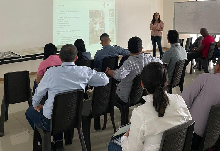
The REXUS project pilot in Nima, Colombia, engaged 20 stakeholders from across the Water-Energy-Food Nexus sectors in an interactive workshop on 3 August 2022, aiming to identify the main environmental challenges from the viewpoint of the local stakeholders of the Nima river sub-basin.
The workshop followed on from previous consultations of the REXUS Nima pilot leader, Ciat, with local authorities, and extensive interviews with local stakeholders including representatives of rural community councils, rural community aqueducts, commercial enterprises, NGOs and others. The latest workshop brought diverse stakeholders together for the first time in face-to-face discussions of local challenges, addressing resource competition between activities and sectors, as well common threats, such as biodiversity decline and climate change impacts.
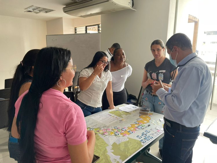
Stakeholder feedback on Nima sub-basin challenges
The group was divided into an ‘upstream’ and ‘downstream’ group, due to differences in the key nature of the pressures. The mapping of upstream challenges revolved around water and land use conflict (forest plantation in vulnerable ecosystems) and lack of basic sanitation conditions, while downstream challenges centered on water pollution from agro-industrial crops and waste discharges from agricultural enterprises and some communities.
Stakeholders explained that both upstream and downstream large-scale economic agricultural activities (pine plantations for paper mills upstream, and sugar cane downstream) create competition for water resources and produce considerable side-effects such as pollution; however, they also provide employment opportunities which are important in the region. More informal economic activities, such a livestock and poultry farming in the frame of subsistence agriculture, help to support incomes but are also the source of pollution, as waste is often dumped in the Nima river. Ecosystems are the recipients of the competition for scarce natural resources and pollution, which threaten the area’s natural values.
Participatory mapping of system dynamics
This input was codified in a collaborative mapping of the area’s Resources, Socio-economic activities, Technologies, and Pressures, and further, in an identification of the main connections between these factors in the form of a Causal Loop Diagram. This diagram presents a qualitative view of the System Dynamics, describing how resources, activities, technologies and pressures are inter-connected. This valuable feedback is providing the basis for the next step in the REXUS analysis, which will attempt to quantify these interconnections and identify potential solutions, including Nature-based Solutions.
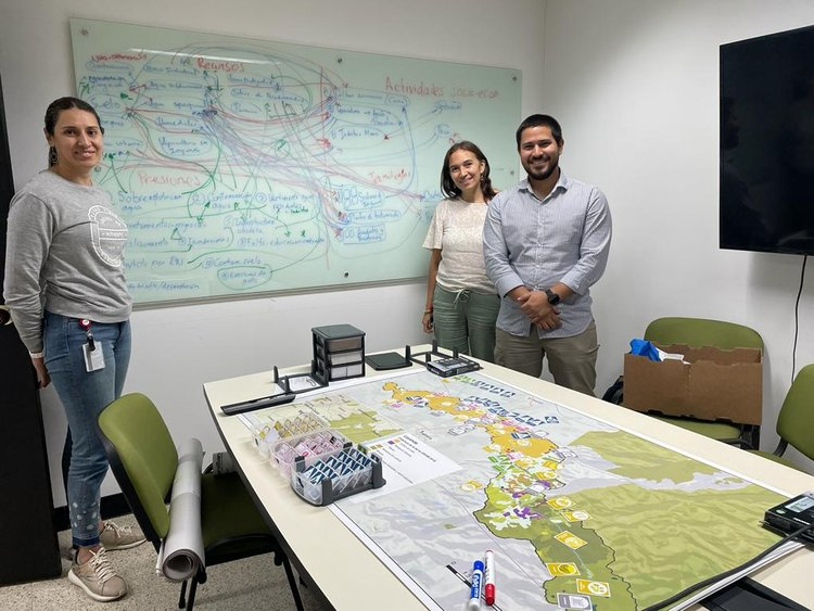
The end goal of the participatory analysis is to successfully map alternative scenarios that can successfully accommodate local visions for a sustainable future. The fruits of this analysis will be shared with local authorities to inform on influencing and assisting the development of the territorial and land use planning of Palmira municipality (POT in Spanish).