
On Tuesday, Nov 29th, 2022, the first Learning and Action Alliance workshop in the REXUS Júcar River basin pilot took place with more than 20 local stakeholders representing water managers, local authorities, farmers cooperatives, research institutes, and other key institutions.

José Gonzalez Piqueras, REXUS Coordinator, UCLM, and Anna Osann, REXUS Scientific Coordinator, Agrisat, introduce the workshop.
The Júcar River basin is a smaller pilot within the broader Peninsular Spain pilot, one of the 5 REXUS pilot areas across Europe and Latin America where the project is deploying an innovative participatory approach to assist the shift from Nexus Thinking to Nexus Doing. Interconnections between the Water-Energy-Food-Ecosystems sectors are analysed, the impact of climate change and the potential of nature-based solutions are both integrated into Nexus analysis, while a suite of scientific tools are co-developed with stakeholders to enhance cross-sectoral cooperation.
The Júcar river basin pilot workshop brought together key local actors across sectors, including the Júcar Hydrographic Confederation, members from the Mediterranean Network of basin Organisations (MENBO), the Provincial Agronomic Technical Institute (ITAP), agricultural cooperatives, the Central Irrigation Board of La Mancha Oriental (JCRMO) and farmers. On behalf of the REXUS consortium, AgriSat Iberia SL, the University of Castilla la Mancha, ICatalist, Draxis, IRSA, and CIRCE contributed to the preparation and running of the meeting.
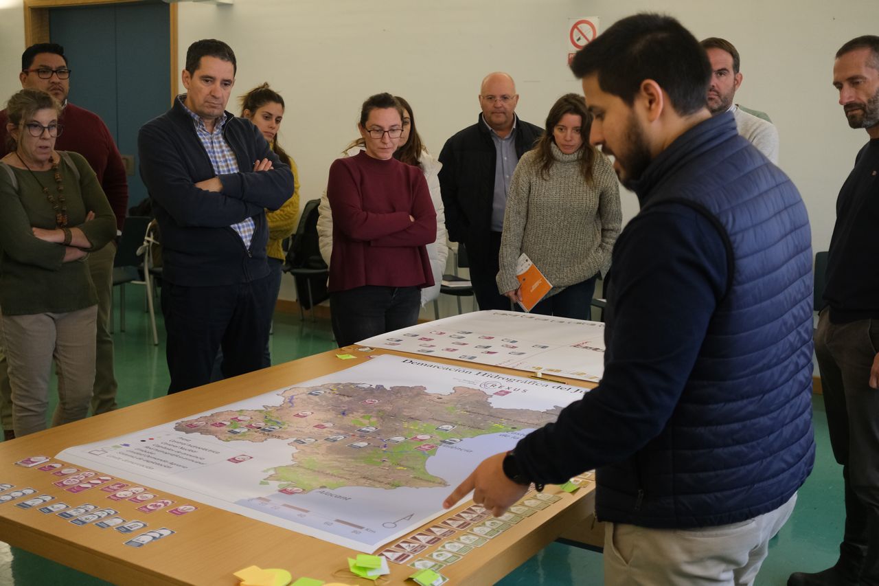
Participatory Mapping of key Nexus System variables
Applying the REXUS innovative participatory methodology, the REXUS team invited stakeholders to engage in an exercise mapping the key elements affecting, in their view, sustainable Nexus management.


Participants were handed custom-made cards to place on a map of the entire basin, the cards representing the five categories of elements of the socio-ecological-technological system: pressures, human activities, infrastructures, resources (both ecological and human), and ecosystem services.
Stakeholders ranked top among the pressures in the area phenomena relating to desertification, drought, salinization, floods, and erosion; also, the lack of coordination between administrations; conflicts over water resources; groundwater pollution; and overexploitation of aquifers.

Stakeholders’ ranking of pressures (threats) in the Júcar river basin system.
Overall, this information shapes the qualitative Causal Loop Diagram, which is the first step in developing the System Dynamics Model for the basin, which allows to project a quantitative analysis of inter-relationships and feedback loops between the system’s key variables over time. As a result, alternative scenarios depending on which course of action is chosen, can be clearly displayed and evaluated by stakeholders.

The IRSA team explaining how the Participatory Mapping exercise leads to the development of System Dynamics Modeling scenarios.
This allows stakeholders to visualise the impact of a course of action, or inaction, and choose the scenario they desire, also getting a clear view of the required measures to get achieve it.

Mapping the Causal Loop Diagram for the Júcar river basin.
In 4 dedicated ‘Stations’, REXUS also presented a series of scientific analysis and tools and their preliminary results for the Júcar river basin, focusing on (a) Water Accounting & land uses, (b) Energy & carbon footprints, (c) Climate projections & risk assessment, and (d) Nature-based Solutions. Participants were invited to give their feedback on these tools and validate results, commenting on their usefulness and practicality.

The UCLM team while validating REXUS results with stakeholders and collecting valuable feedback.
For example, the REXUS project’s work on Remote Sensing based Agricultural Water Accounting and Footprint attracted a lot of interest, with water user association representatives commenting that satellite-based information is a new and valuable addition to help users with water resources, since real-time information was previously not available without remote sensing data. On their part, farmers highlighted future desirable directions for research, like quantifying the impact on water needs from potential land use changes, such as would result from a potential increase in almond crop surfaces.
Integrating Nature-based Solutions in a Nexus Framework
Lively discussions also centred around Nature-based Solutions (NbS), one of the key innovative contributions of the REXUS project being the incorporation of NbS within a Water-Energy-Food-Climate Nexus framework. REXUS has developed socioeconomic indicators for ecosystem services which allow to quantify and measure costs and benefits, while also helping to select the most suitable Nature-based Solutions in an area. Stakeholders stressed that the examination of Nature-based solutions needs to aim towards the improvement, rather than only the restoration, of systems, accepting that human intervention is a given. Some stakeholders volunteered to collaborate and assist with the implementation of NbS in specific river sections.
At the end of the meeting, Anna Osann from AgriSat, REXUS scientific coordinator, highlighted the importance of this participatory process and the progress marked, noting that more work will come and that all the present discussion will allow the REXUS consortium to feed different models that will enable to implement different solutions in the area.